


17 HOSC Voting District, Coffee County, Tennessee
About
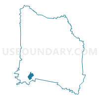
Outline

Summary
| Unique Area Identifier | 668184 |
| Name | 17 HOSC Voting District |
| County | Coffee County |
| State | Tennessee |
| Area (square miles) | 2.22 |
| Land Area (square miles) | 2.22 |
| Water Area (square miles) | 0.00 |
| % of Land Area | 100.00 |
| % of Water Area | 0.00 |
| Latitude of the Internal Point | 35.37485940 |
| Longtitude of the Internal Point | -86.18477250 |
Maps


Graphs
Select a template below for downloading or customizing gragh for 17 HOSC Voting District, Coffee County, Tennessee


Neighbors
Neighoring Voting District (by Name) Neighboring Voting District on the Map
- 14 Hickerson Fire Hall Voting District, Coffee County, TN
- 16 Lion's Club Voting District, Coffee County, TN
- 18 First Christian Church Voting District, Coffee County, TN
- 19 CD Stamps Center Voting District, Coffee County, TN
Top 10 Neighboring County Subdivision (by Population) Neighboring County Subdivision on the Map
- District 17, Coffee County, TN (2,569)
- District 16, Coffee County, TN (2,385)
- District 18, Coffee County, TN (2,309)
- District 14, Coffee County, TN (2,258)
- District 19, Coffee County, TN (2,160)
Top 10 Neighboring Place (by Population) Neighboring Place on the Map
Top 10 Neighboring Unified School District (by Population) Neighboring Unified School District on the Map
Top 10 Neighboring State Legislative District Lower Chamber (by Population) Neighboring State Legislative District Lower Chamber on the Map
Top 10 Neighboring State Legislative District Upper Chamber (by Population) Neighboring State Legislative District Upper Chamber on the Map
Top 10 Neighboring 111th Congressional District (by Population) Neighboring 111th Congressional District on the Map
Top 10 Neighboring Census Tract (by Population) Neighboring Census Tract on the Map
- Census Tract 9708.02, Coffee County, TN (5,982)
- Census Tract 9709, Coffee County, TN (4,093)
- Census Tract 9708.01, Coffee County, TN (3,932)